Experimental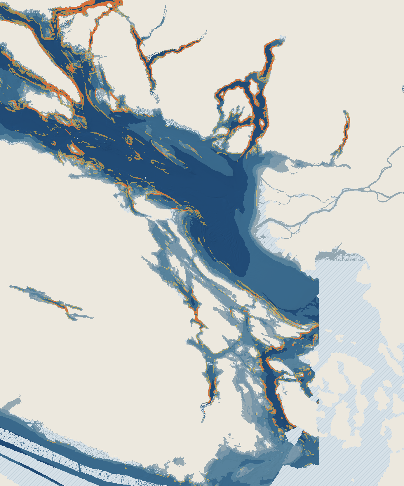
Seabed Explorer
Strait of Georgia and the Gulf Islands, plus a northern area up to Quadra Island. Seabed from the free CHS NONNA 100 m depth grid, with modelled currents for a time window you pick.
Area
Pick a time window (Pacific time)
Zoom 1x. Drag to move, pinch or use + and - to zoom. Zooming only enlarges the same 100 m seabed and 500 m model data. It does not add detail.
0-20 m20-5050-100100-200200+Steep drop-offVery steepLandWater, no CHS seabed surveyWorth a lookNamed in local fishing reports
Border and rules. The dashed red line is the Canada-US boundary (NOAA Maritime Limits and Boundaries line, via Marine Regions/VLIZ). It is a simplified line with 14 turning points, so it is not for navigation or legal use. Dots are only placed on the Canadian side and at least 1.5 km from the line. US-side waters and waters close to the line get no dots, because we only have Canadian seabed data and no US side data is loaded yet. The shaded US side is not surveyed here, it just has no data on this page. Fishing rules, licences and boat or crossing requirements differ on each side of the border and change often. Check the current rules for the side you are on: DFO (Canada) and WDFW (Washington). Nothing here says that any crossing or entry requirement is met.
Fish notes (general, not tied to the dots). A dot is seabed shape plus a modelled current. It does not say fish are there. For context only, with dates and sources:
- Georgia Strait winter Chinook report, Nov 20, 2025 (Harbour Chandler, a Nanaimo tackle shop): winter "feeder" Chinook were close to the bottom in deep water, fished at about 200 ft off Entrance Island reef, and tight inshore spots gave mostly undersized fish.
- Georgia Strait Chinook report, Jul 24, 2026 (Harbour Chandler): fish had moved deeper, with fishing close to the bottom in 225-240 ft effective.
- Recent reports, with dates: Discovery Passage, Oct 17, 2026 (Fishing Storie Charters): winter Chinook fished deep, 100 to 150 ft. Discovery Passage, Oct 7, 2026 (same charter): coho at 30 to 60 ft. Strait of Georgia, Oct 9, 2026 (Harbour Chandler): mature Chinook holding deep (the report gives a depth figure with no unit, so it is not repeated here).
- Research: Saygili and Trites 2024 (PLOS ONE, doi 10.1371/journal.pone.0311388) found adult Chinook in Juan de Fuca and Salish Sea feeding areas in late summer concentrated from the bottom to about 25 m above it. That was a late-summer survey, not a Gulf Islands fall forecast.
Experimental: what the yellow dots mean. Where a dot sits on a long continuous steep band, the popup also gives that band's top and base depth. That is seabed depth only, not a fish depth. The popup also repeats dated nearby reports. A dot marks a steep, well-surveyed part of the seabed where the model's current near the bottom averages at least 0.6 knots (0.3 m/s) over the chosen window. That is a simple rule we picked, shape plus flow, and nothing more. It is not a confirmed fishing spot and does not say fish are there. The current is a SalishSeaCast model value on a 500 m grid at the model level just above the bottom (the popup names the depth), so it is rough near shore and in narrow channels. Where the model bottom is much deeper than the deepest level we use, or does not match the chart depth, no dot is placed. Dots also need dense survey cover, none are placed in Juan de Fuca Strait where the survey shows line artefacts, and the bottom current is far weaker than the surface, so there are few dots.
Yellow dots and arrows are tools to explore, not advice.
Yellow dots and arrows are tools to explore, not advice.
Depths are metres below chart datum, not the tide at any moment. Steep drop-offs come from the depth grid only (where depth changes quickly over 100 m). Cream is land. The pale hatched water has no CHS survey data in this grid.
This product was made by TightLinesBC and contains intellectual property of the Canadian Hydrographic Service (CHS) of the Department of Fisheries and Oceans. This product does not meet the requirements of the Navigation Safety Regulations, 2020 under the Canada Shipping Act, 2001. Charts and publications issued by or on the authority of CHS must be used to meet the requirements of those regulations. The copyright in the data are and remain the property of His Majesty the King in Right of Canada and shall not be sold, licensed, leased, assigned or given to a third party. The incorporation of CHS data in this product does not constitute an endorsement or an approval of this product by the Canadian Hydrographic Service, the Department of Fisheries and Oceans or His Majesty the King in Right of Canada.